The River Olza
(Barbara Stalmachova & Jan Stalmach (from:”Olza - od pramene po ujście”:”Przyroda”, publisher: Region Silesia s.r.o. 2000) translated by D.French
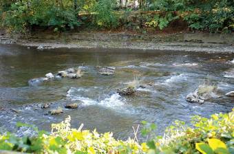
The Olza’s source is in Poland; in the Silesian Beskid Mountains. It is formed from small mountain streams which emerge mainly on the Western slopes of Gańczorka (909 m above sea level), and partly from Tyniok (891 m above sea level) and Koczy Zamek (846 m above sea level). The Olza’s other important tributaries are; the Łomna joining near Jablunkov (Jabłonków) from the left, the Głuchowa coming in from the right near Bystřice, and the Wędrynka which flows through Wędrynia. Just before Český Těąín we find the Ropiczanka flows on the left, before Cieszyn the Puńcówka joins it from the right, and beyond Cieszyn the Bobrówka flows in from the right. The Stonavka is the largest tributary flowing in from the left in Karvina. Between Godov and Dziećmorowice the Piotrówka, which for a short section here actually forms the Polish-Czech border, joins the Olza. In the Kopytów district of Bohumin, at an altitude of 195 m above sea level, the Olza flows into the Odra (Oder) – indicating that it belongs to the Baltic drainage basin. The total length of the River Olza is 99 km, the area of its river basin is 1115 km², and the average flow speed at the point of entry to the Odra is 12.5 m³/s.
The land that the Olza flows through can be described broadly as belonging to two orogenetic systems. The eastern part belongs the Western Carpathian (the Carpathian Flysch range), the western part mainly to the Ostravian Basin. Climatic conditions vary. The Silesia Beskid mountain range belongs to the Carpathian climatic region, a moderately warm/hot region, although that depends on the height above sea level.
Great swings in temperature and air pressure are possible even during the course of a single day. The prevalent winds are southerly and south-westerly. Rainfall is greatest in June and July, while autumn can be foggy, and during the winter in the valleys temperature inversions in the atmosphere are common. The percentage of snowfall and the length of snow-cover increases with height above sea level. All the climatic indices, particularly temperature are milder in the part belonging to the Ostravian Basin. The height above sea level, the landscape and other geographical factors all contribute to determine the range of wildlife inhabiting the River Olza’s drainage basin.
Life in the Olza, which is still relatively unpolluted, is rich and varied. This is evidenced in the wide range of animal life, often representing rare or protected species. An important factor is the favourable feeding conditions. The sufficiency of food and light contributes to high primary production of plants. The food base of the river ecosystem is enhanced by various vegetable remains such as leaves, grass and wood. The brown sludge called detritus formed in this way is processed by bacteria and fungi but is also the food source of various lower creatures such as the larvae of various types of caddis-flies, water insects and omnivorous molluscs which later become the food of higher animals, such as; fish, amphibians, birds and mammals.
General information
The Olza is the second longest river in the Silesian Beskid Mountains belonging to the Odra’s drainage basin after the Vistula. It has a length of 99 km, 16 km of which are in Poland and 83 of which are in the Czech Republic.
The History of the Olza
The Olza is not a great river, with a length of only 99 km, in comparison with the world’s longest river, the Nile at 6671 km; the Odra, which the Olza supplies, at 854 km; the Vistula, whose source is close to the Olza’s sources, at 1047 km, the Labe at 1154 km, and the Vltava at 430 km.
The Name
The Olza and the old argument about the name of the river was not a Polish-Czech matter, as there was support on both sides of the border for Olza and Olsza (Oląe). There had been discussions and arguments about what the river should be called in Polish and Czech newspapers since the 19th century.
Wildlife
The Olza is a river which emerges in the mountains where the current and turbulence define basic ecological processes. In the area around the source species of plants and animals typical for mountain springs in mixed, broadleaved and coniferous forests can be found.


